 OUSD Research and Engineering
  West Point
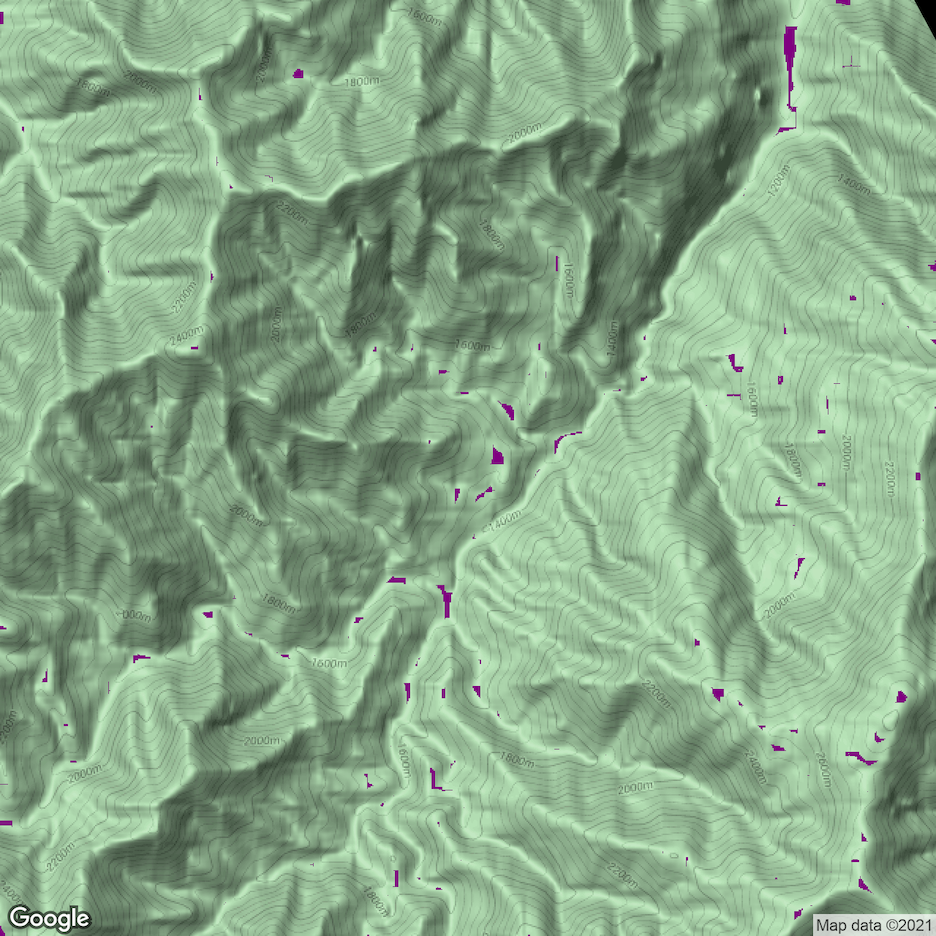
Abstract
Missions require a significant amount of preparation to ensure success in a safe and efficient manner. While optimizing the route from point A to point B is extremely important (and is tackled by another team in this initiative), deciding where those points should be is a separate--equally important--issue.
By leveraging certain machine learning / computer vision methods, we can create a platform that aids mission planners in selecting landing zones or drop zones that optimize a number of considerations, factoring in aircraft specifications, various risk factors, and proximity to urban centers and other key points of interest.
Problem Statement
Maps are as valuable as they are dense when informing leaders about how they wish to execute various missions. Even in small, tactical areas of operation, it takes a nontrivial amount of time to locate advantageous terrain features and work through the best points for infiltration, exfiltration, and key movements. Expand your area of operation even a little bit, and the mental work increases exponentially.
Having a tool that could analyze miles of terrain to select such points and clearly mark such terrain features would be useful during the mission planning process. Frontrunner aims to be such a tool.
Proposal
In it's current state, Frontrunner uses open-source (Google's API on satellite and topographical data) information about specific regions to select landing zones (LZs) for arbitrarily-sized aircraft. Simply put: you feed it the coordinates of an objective, and the program spits out several options for LZs, each optimizing for speed, safety, and elevation change.
As a very early prototype for our final product, this current state reflects some of the core functions of our proposal. Frontrunner is meant to be a terrain-analysis tool for mission planners which can give helpful information and risk-assessments as to the strengths and weaknesses of DZ/LZs in a given area. We see an obvious partnership with the route-planning team and have considered even expanding the scope of the project further to address aerial-route planning as well (i.e. selecting helicopter travel paths).
Challenges and Unknowns
This is not a new problem and we are sure that various organizations have established all sorts of standard operating procedures and criteria for selecting such points in operations. Understanding these and the interests of mission planners/end users will serve as one of our most important challenges in creating this product. This tool is meant to augment existing processes to allow for more informed decision-making, not necessarily replace them.
Another challenge will be obtaining higher-fidelity terrain and satellite information to train/test our models on. We have been using Google's data because it is easily accessible, thought obviously our tool should be compatible with whatever the standard is, currently.